Kootenai Falls: Montana’s Majestic Waterfall & Swinging Bridge

Kootenai Falls

Kootenai Falls: Montana’s Majestic Waterfall & Swinging Bridge

Nestled in the rugged landscapes of Lincoln County, Montana, Kootenai Falls stands as a testament to nature’s grandeur and spiritual significance. As the largest undammed waterfall in the state, it offers visitors a unique blend of natural beauty, cultural heritage, and outdoor adventure.

A Sacred Site with Rich History

For the Kootenai Tribe, the falls are more than just a natural wonder—they are a sacred site viewed as the “center of the world,” where tribal members commune with spiritual forces. In the early 1800s, Canadian explorer David Thompson navigated this area, following trails marked by the Kootenai people.

Location & Access

Kootenai Falls is located along U.S. Route 2, approximately 12 miles west of Libby and 6 miles east of Troy. The falls are accessible via a short hike from a well-marked parking area on the north side of the highway.

Geological Marvel

The falls are part of the Kootenai River, which drops 90 feet over a series of rapids and cascades within a mile. The main waterfall boasts a 30-foot drop and spans nearly 1,000 feet in width, making it one of the widest waterfalls in the United States.

The Iconic Swinging Bridge

Just downstream from the falls lies the Kootenai Falls Swinging Bridge, a 210-foot-long suspension bridge originally constructed in the 1930s by the Civilian Conservation Corps to aid firefighting efforts. Rebuilt in 2019 to accommodate increasing visitors, the bridge offers panoramic views of the river and surrounding forest.

Hiking & Wildlife

Visitors can embark on a 1.6-mile round-trip hike that leads to both the falls and the swinging bridge. The trail begins with a level path, followed by a descent over a railroad overpass and a series of stairs. Along the way, hikers may encounter diverse wildlife, including bighorn sheep, black bears, moose, and bald eagles.

Nearby Attractions

  • Kootenai National Forest: Encompassing over 2.2 million acres, this forest offers opportunities for hiking, camping, and wildlife viewing.

  • Lake Koocanusa Scenic Byway: A 67-mile drive along Highway 37, providing stunning views of the lake and access to recreational activities.

  • Cabinet Mountains Wilderness: Located within the Kootenai National Forest, this area features rugged, glacier-carved mountains ideal for backcountry exploration.

Visitor Tips

  • Best Time to Visit: Late spring to early summer offers the most impressive water flow.

  • Facilities: The parking area includes restrooms, picnic tables, and a seasonal concession stand.

  • Safety: Exercise caution near the water’s edge, as there are no guardrails. Keep a safe distance from wildlife and supervise children closely.

Conclusion

Kootenai Falls is a must-visit destination for those seeking natural beauty, cultural depth, and outdoor adventure. Whether you’re passing through on a road trip or planning a dedicated visit, the falls and their surrounding attractions offer an unforgettable Montana experience.

Running Eagle Falls

Running Eagle Falls, Two Medicine, Glacier National Park

Running Eagle Falls: A Tribute to a Blackfeet Warrior in Glacier National Park

Nestled within the serene Two Medicine Valley of Glacier National Park, Running Eagle Falls stands as both a natural marvel and a monument to the indomitable spirit of a legendary Blackfeet woman warrior. Known also as Trick Falls, this unique waterfall offers visitors not only breathtaking views but also a deep connection to the rich cultural tapestry of the region.

The Legacy of Running Eagle (Pitamakan)

Running Eagle, born Pi’tamaka or Brown Weasel Woman, was a member of the Piikáni (Piegan) band of the Blackfeet Nation. Defying the gender norms of her time, she pursued the path of a warrior, mastering hunting and combat skills traditionally reserved for men. Her courage was epitomized during a hunting expedition when she rescued her father under enemy fire, an act that earned her the right to sing the Victory Song and participate in the Scalp Dance—honors seldom bestowed upon women.

Seeking spiritual affirmation of her warrior role, Running Eagle embarked on a vision quest near the very falls that now bear her name. There, she received a vision from the sun, promising her success in battle if she vowed never to marry. Embracing this path, she led numerous successful raids and was eventually honored with the male warrior name “Running Eagle,” a title reflecting her exceptional status. Her life was tragically cut short in battle against the Flathead tribe after 1878, but her legacy endures in the landscapes of Glacier National Park.

Exploring Running Eagle Falls

Running Eagle Falls is renowned for its distinctive two-tiered cascade. During spring and early summer, snowmelt creates an upper waterfall that flows over the cliff, concealing the lower falls. As the season progresses and water levels recede, the upper falls diminish, revealing the lower cascade that appears to emerge mysteriously from the rock face—a phenomenon that inspired the nickname “Trick Falls.”

Trail Details

  • Distance: 0.6 miles (0.96 km) round trip

  • Elevation Gain: Approximately 30 feet (9 meters)

  • Difficulty: Easy; suitable for families and accessible for wheelchairs up to the viewing platform

  • Trailhead Location: Approximately 1.1 miles west of the Two Medicine entrance station

The trail meanders through a lush forest, crosses a wooden footbridge, and culminates at a viewing platform offering stunning vistas of the falls. Interpretive signs along the path provide insights into the area’s natural and cultural history.

Best Times to Visit

  • Late Spring to Early Summer (May–June): Witness the dual cascades during peak snowmelt.

  • Mid to Late Summer (July–August): Enjoy clearer views of the lower falls and warmer temperatures.

  • Early Morning or Late Afternoon: Experience softer lighting for photography and increased chances of wildlife sightings, such as moose near the creek.

Getting There

From Highway 49, turn onto Two Medicine Road and drive approximately 4.5 miles west to reach the parking area for Running Eagle Falls. The trailhead is clearly marked, and restrooms are available at the parking lot. Note that during peak summer months, Glacier National Park requires vehicle reservations for certain areas, including Two Medicine. Be sure to check the National Park Service website for the latest information on reservations and park fees.

Tips for Visitors

  • Bear Safety: Carry bear spray and remain vigilant, as Glacier National Park is home to both black and grizzly bears.

  • Footwear: Wear sturdy shoes suitable for uneven terrain, especially if you plan to explore beyond the viewing platform.

  • Stay on Designated Trails: To protect the delicate ecosystem and for your safety, avoid venturing off-trail.

  • Leave No Trace: Pack out all trash and respect the natural environment.

Honoring a Heroine

Running Eagle Falls is more than a scenic destination; it is a place of profound cultural significance. For the Blackfeet Nation, the falls are a sacred site, commemorating a woman whose life challenged societal norms and whose bravery continues to inspire. As you stand before the cascading waters, take a moment to reflect on Running Eagle’s legacy—a testament to courage, resilience, and the enduring spirit of the Blackfeet people.

Explore Two Medicine Lake: Glacier National Park’s Hidden Secret

Two Medicine Lake: Glacier National Park

Explore Two Medicine Lake: Glacier National Park’s Hidden Secret

Nestled in the southeastern corner of Glacier National Park, Two Medicine Lake offers a tranquil retreat away from the park’s more frequented areas. Once a primary destination before the Going-to-the-Sun Road was constructed, this area now provides visitors with breathtaking scenery, diverse hiking opportunities, serene waterfalls, and a rich cultural history.

Hiking Trails for Every Adventurer

Two Medicine boasts a variety of trails suitable for all skill levels:

  • Running Eagle Falls Trail: An easy 0.3-mile accessible trail leading to the unique “Trick Falls,” where water cascades from two different sources.

  • Aster Falls Trail: A gentle 1.2-mile hike to a picturesque waterfall, ideal for families.

  • Rockwell Falls Trail: A 3.5-mile trek through forests and meadows culminating at the stunning Rockwell Falls.

  • Scenic Point Trail: A challenging 3.9-mile ascent offering panoramic views of the Two Medicine Valley.

  • Dawson-Pitamakan Loop: A strenuous 17.4-mile loop traversing high alpine passes with sweeping vistas.

Waterfalls Worth the Walk

The area is home to several captivating waterfalls:

  • Running Eagle Falls: Also known as “Trick Falls,” this unique waterfall appears to emerge from a cave during certain times of the year.

  • Twin Falls: Accessible via a 3.5-mile hike or a combination of boat ride and shorter hike, these twin cascades are a serene spot for relaxation.

  • Rockwell Falls: A multi-tiered waterfall reached by a moderate hike, offering a peaceful setting amidst lush surroundings.

Running Eagle Falls: Also known as "Trick Falls"
Running Eagle Falls: Also known as “Trick Falls”

Camping Amidst Nature

Two Medicine Campground provides 100 campsites near the lake, operating on a first-come, first-served basis. Amenities include potable water, restrooms, and proximity to trailheads. Note that the campground will be closed for construction starting September 16, 2025.

For a more rustic experience, No Name Lake Campground offers backcountry camping accessible via a 5-mile hike.

Boating and Rentals

Experience the lake’s tranquility with a boat tour or rental:

  • Boat Tours: The historic “Sinopah” boat offers narrated tours across Two Medicine Lake, providing insights into the area’s history and geology.

  • Boat Rentals: Kayaks, canoes, rowboats, and motorboats are available for rent, allowing visitors to explore at their own pace.

Concessions and Amenities

The Two Medicine General Store offers snacks, beverages, souvenirs, and basic camping supplies. It’s a convenient stop for hikers and campers alike.

Getting There

Two Medicine Lake is approximately 13 miles from East Glacier Park. From U.S. Highway 2, take Montana Highway 49 north to the Two Medicine Road, then drive west to the lake. The route is well-marked and offers scenic views along the way.


Whether you’re seeking adventure or tranquility, Two Medicine Lake provides a memorable experience amidst Glacier National Park’s natural splendor.

Explore Polebridge Montana & Historic Polebridge Mercantile

Polebridge Montana & Historic Polebridge Mercantile

Nestled in the remote wilderness of northwestern Montana, Polebridge is a hidden gem that offers a unique blend of history, rustic charm, and unparalleled access to the natural wonders of Glacier National Park. At the heart of this tiny, off-the-grid community lies the iconic Polebridge Mercantile, a century-old establishment that continues to serve as a beacon for adventurers and nature enthusiasts alike. (Polebridge Mercantile and Bakery)

🏔️ A Glimpse into Polebridge’s Past

Established in 1914 by William L. “Bill” Adair, the Polebridge Mercantile has been a cornerstone of the North Fork community for over a century. Originally known as Adair’s, the Mercantile was more than just a store; it was a gathering place for homesteaders and travelers in the rugged Montana frontier. Adair’s wife managed the store while he tended to their homestead, which included growing king-sized cabbages and fishing with a single fly, the Coachman. The Mercantile’s log walls, hand-hewn by Adair himself, still stand today, adorned with the same wallpaper he applied over a hundred years ago.

The community of Polebridge, named after a log bridge that once spanned the North Fork Flathead River, remains largely unchanged, preserving its rustic charm and historical significance. With no electricity or cell service, Polebridge offers a true escape from modern life, allowing visitors to immerse themselves in the tranquility of nature.


🥐 The Polebridge Mercantile: A Culinary Oasis

Today, the Polebridge Mercantile continues to serve as a general store, bakery, and base camp for explorers venturing into Glacier National Park. Renowned for its delectable baked goods, the Mercantile offers an array of treats, including their famous huckleberry bear claws, cinnamon rolls, macaroons, and fresh-baked bread. Visitors can also enjoy deli sandwiches, signature pizzas, and a selection of beverages ranging from Montana microbrews to huckleberry soda. 

Adjacent to the Mercantile, the Northern Lights Saloon—once the Adair homestead cabin—provides a cozy spot to relax and savor the flavors of the region. The Mercantile also offers rustic cabin accommodations, allowing guests to extend their stay and fully experience the serenity of the North Fork Valley. 


🌲 Nearby Natural Wonders

Glacier National Park

Just a short drive from Polebridge, Glacier National Park boasts over a million acres of pristine wilderness, including rugged mountains, alpine meadows, and over 700 miles of hiking trails. The park’s diverse ecosystems and abundant wildlife make it a paradise for outdoor enthusiasts. 

Bowman Lake

Accessible via a 6-mile unpaved road from Polebridge, Bowman Lake is the third-largest lake in Glacier National Park. Its crystal-clear waters are ideal for kayaking, canoeing, and fishing. The surrounding area offers numerous hiking trails and a tranquil campground nestled among the trees. 

Kintla Lake

Located in one of the park’s most remote regions, Kintla Lake offers a serene setting for non-motorized boating and fishing. The lake’s secluded campground is rarely crowded, providing a peaceful retreat for those seeking solitude amidst nature’s beauty. 


🚶‍♂️ Outdoor Adventures

The area surrounding Polebridge is a haven for outdoor activities:

  • Hiking: Explore trails leading to stunning vistas, alpine lakes, and diverse wildlife habitats.

  • Fishing: Cast a line in the North Fork Flathead River or nearby lakes teeming with trout.

  • Boating: Paddle through the calm waters of Bowman and Kintla Lakes, surrounded by breathtaking mountain scenery.

  • Wildlife Viewing: Keep an eye out for bears, moose, and a variety of bird species that inhabit the region.

Biking Going-to-the-Sun Road in Spring | Glacier National Park

Biking Going-to-the-Sun Road in Spring

Each spring, as Glacier National Park awakens from its long winter slumber, a rare window of adventure opens on one of America’s most scenic roads. Before motor vehicle access begins, the Going-to-the-Sun Road is open only to pedestrians and cyclists, giving you a peaceful, breathtaking journey through towering peaks, waterfalls, and wildlife—free from traffic noise and engine exhaust.

We captured this once-a-year experience in a 15-minute time-lapse video of a 2-hour, 29-mile round trip ride to Heavens Peak Overlook, which is currently the farthest accessible point during snow plowing operations.


The Road That Defied the Mountains

Completed in 1932, Going-to-the-Sun Road is a National Historic Civil Engineering Landmark. It cuts a 50-mile swath across Glacier National Park, scaling the Continental Divide at Logan Pass (6,646 ft). Carved into mountain cliffs, with tight switchbacks and dramatic drop-offs, it was an unprecedented engineering feat of its time.

The road is named for Going-to-the-Sun Mountain, a striking peak visible from many points along the eastern stretch. Legend says the mountain was named by the Blackfeet people, who believed a spirit ascended the mountain to return to the sun.


What You’ll See Along the Way

Even in early spring, the route teems with beauty:

  • Lake McDonald: Begin your ride at the shimmering shores of this 10-mile-long glacial lake, surrounded by cedar forests.

  • Sacred Dancing Cascade & McDonald Falls: Thundering waterfalls at peak snowmelt.

  • Avalanche Creek Area: A popular trailhead for hikes like Avalanche Lake, which rewards visitors with a spectacular view of hanging glaciers.

  • Bird Woman Falls: One of the tallest waterfalls in the park, often visible en route to Heavens Peak Overlook.

  • Heavens Peak: Your turnaround point. This jagged summit stands over 8,900 ft and marks one of the most scenic spots along the road before the alpine section is plowed.


Know Before You Go

  • Bring warm clothing: Temperatures can be chilly in the morning but warm significantly by midday.

  • Layers are key: Wear moisture-wicking base layers and a windbreaker.

  • Bring bear spray: This is grizzly country. If you’re hiking, especially around Avalanche Lake, it’s a must.

  • No cars: This unique spring experience is free from vehicle traffic—just you, your bike, and the mountains.


Watch the Journey

Experience the magic in just 15 minutes with our time-lapse video of the full ride from Lake McDonald Lodge to Heavens Peak Overlook and back.

Conclusion

For cyclists and hikers, this is the best time of year to enjoy the Going-to-the-Sun Road. You’ll witness a quieter, more intimate Glacier National Park—no honking, no crowding, just you and one of the most scenic roads in the world.

Discover the Hungry Horse Dam & Reservoir in Montana

Hungry Horse Dam & Reservoir in Montana

Discover the Hungry Horse Dam and Reservoir in Montana

Nestled in the picturesque Flathead Valley near Glacier National Park, the Hungry Horse Dam and Reservoir is one of Montana’s most impressive engineering feats and beloved recreation areas.

A Brief History

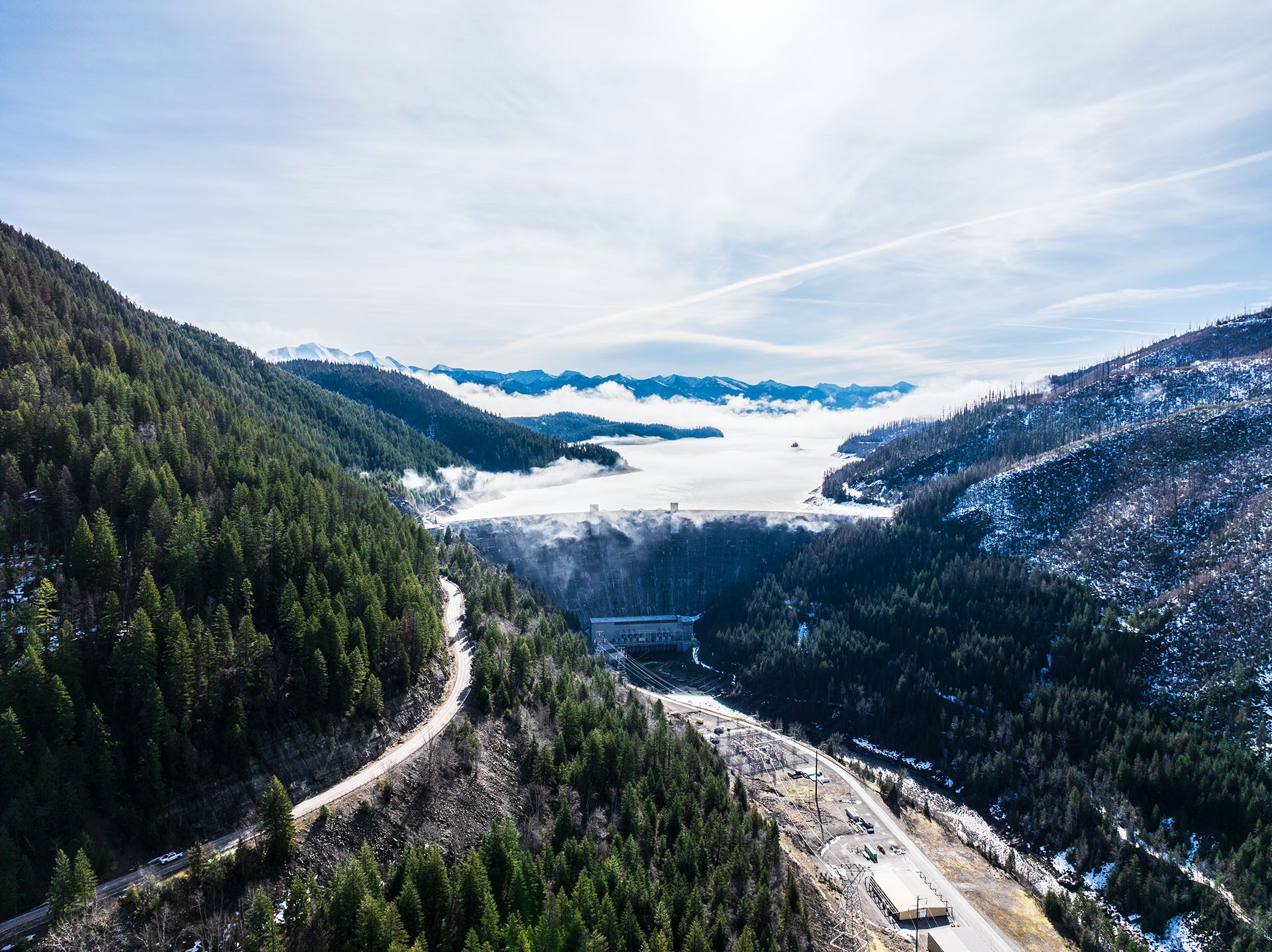
Construction of the Hungry Horse Dam began in 1948 and was completed in 1953 by the Bureau of Reclamation. Named after the nearby town of Hungry Horse, the dam was built primarily for flood control, hydroelectric power generation, and to aid irrigation.

Engineering Marvel

At 564 feet high and 2,115 feet long, Hungry Horse Dam stands as the 10th highest dam in the United States. Constructed from 3 million cubic yards of concrete, it creates a vast reservoir covering approximately 23,800 acres, with over 170 miles of shoreline.

Recreational Activities

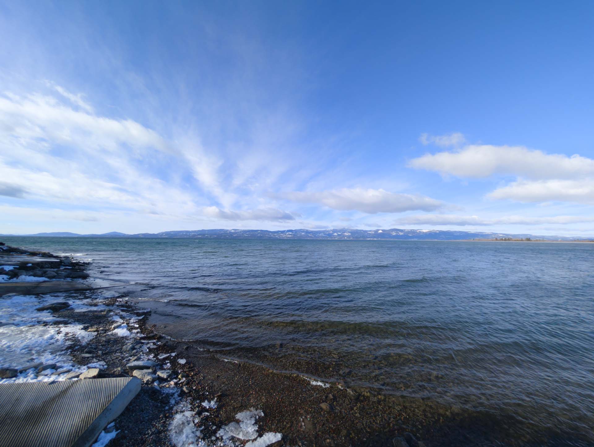
Hungry Horse Reservoir is renowned for its clear waters and abundant recreational opportunities:

  • Boating & Fishing: Anglers frequently visit to catch trout, salmon, and whitefish. The reservoir’s calm waters are perfect for kayaking, canoeing, and motor boating.

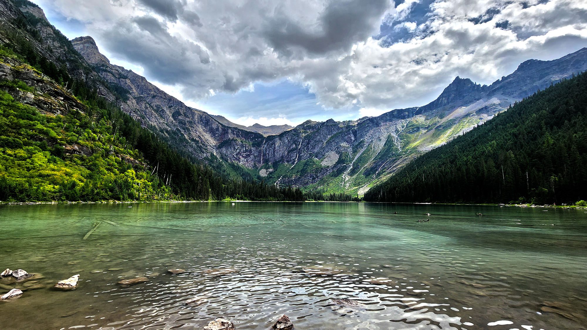
  • Camping & Hiking: Numerous campsites surround the reservoir, offering both primitive and developed camping experiences. Popular trails include the Jewel Basin Hiking Area and Doris Creek Trail.

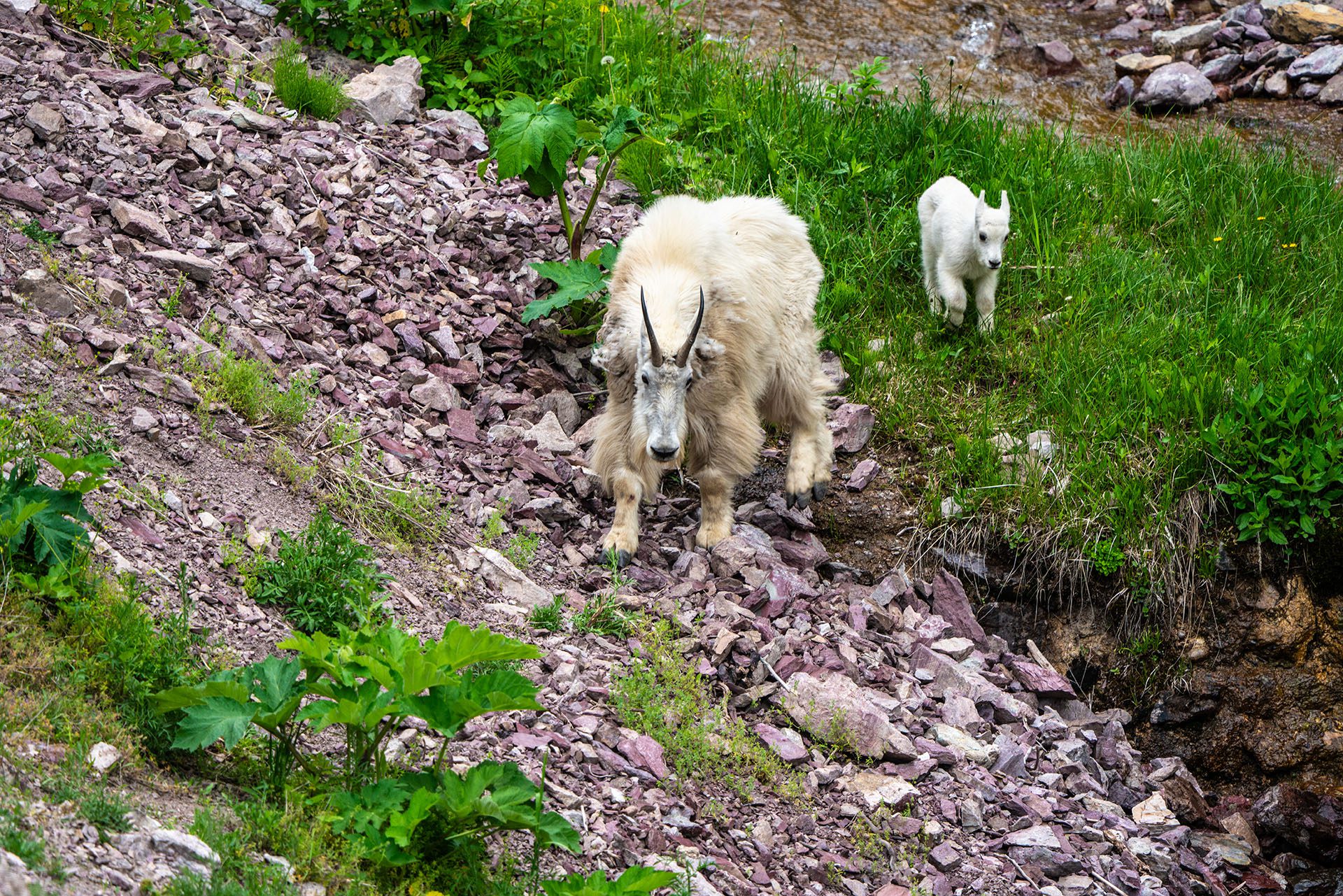
  • Wildlife Watching: The area is home to diverse wildlife, including deer, elk, bears, and bald eagles.

Interesting Facts

  • The Hungry Horse Dam provides power for approximately 270,000 homes.

  • It’s part of the Columbia River Basin, playing a critical role in managing water flow in the region.

  • Visitors can tour the dam and learn about its construction and significance at the visitor center.

Visiting the Hungry Horse Dam

The dam and reservoir are open year-round, with peak visitation during the warmer months from May through October. It’s accessible via a short drive from Kalispell, Columbia Falls, or Whitefish, making it an excellent day-trip destination.

Whether you’re interested in history, engineering, or outdoor adventures, the Hungry Horse Dam and Reservoir offer something for everyone.

Best Things to Do in Glacier National Park in the Spring

Best Things to Do in Glacier National Park in the Spring viewing Mountain Goats

Exploring Glacier National Park in the Spring: What to See & Do

Spring is one of the most magical times to visit Glacier National Park in Montana. As the snow begins to melt, waterfalls cascade down mountainsides, wildlife emerges from hibernation, and the park transforms into a breathtaking landscape of lush greenery and crystal-clear lakes. If you’re looking for an adventure in Montana this spring, here’s everything you need to know about visiting Glacier National Park!

Why Visit Glacier National Park in the Spring?

Spring offers a unique experience compared to the busy summer months. Here are some key reasons to plan your visit:

  • Fewer Crowds – Enjoy the park’s beauty without the summer tourist rush.

  • Wildlife Viewing – Bears, elk, and mountain goats are more active.

  • Gushing Waterfalls – Snowmelt fuels the park’s stunning waterfalls.

  • Affordable Lodging – Lower rates at nearby hotels and campgrounds.

Best Things to Do in Glacier National Park in the Spring

1. Go for a Scenic Drive

Many roads in Glacier National Park begin opening in phases during the spring, offering incredible opportunities for scenic drives. The Going-to-the-Sun Road, one of the most famous routes in the U.S., typically starts opening in May or June, depending on snow conditions. Even if the full road isn’t open, visitors can drive portions of it and take in breathtaking views.

2. Explore Stunning Waterfalls

Spring is peak waterfall season in Glacier National Park, thanks to the melting snow. Some must-see waterfalls include:

  • McDonald Falls – Easily accessible and just a short walk from the road.

  • Virginia Falls – A moderate hike rewards you with a stunning cascade.

  • Running Eagle Falls – A unique waterfall with two streams flowing through one rock formation.

3. Go Hiking on Lower Elevation Trails

While high-altitude trails may still be covered in snow, lower-elevation hikes are perfect for spring exploration. Great options include:

  • Apgar Lookout Trail – Offers panoramic views of Lake McDonald.

  • Avalanche Lake Trail – A classic hike with breathtaking scenery.

  • Trail of the Cedars – An easy, accessible loop through an ancient forest.

4. Wildlife Watching

Spring is an excellent time to see Glacier’s diverse wildlife. Keep an eye out for:

  • Grizzly and black bears emerging from hibernation.

  • Mountain goats and bighorn sheep on rocky cliffs.

  • Moose and elk grazing in meadows.

  • Birdwatching opportunities as migratory species return.

5. Take a Boat Tour on Lake McDonald

If the weather permits, a boat tour on Lake McDonald offers a peaceful way to experience the park’s beauty. The reflections of snow-capped peaks on the water make for stunning photographs!

6. Visit Apgar Village

Apgar Village, near the park’s west entrance, is a great spot to grab a meal, rent a bike, or visit the Glacier National Park Visitor Center. It’s a great basecamp for springtime exploration.

7. Enjoy Photography Opportunities

Spring provides some of the best photography conditions in Glacier National Park, with fresh snow on the mountains, vibrant wildflowers beginning to bloom, and stunning sunsets over the lakes.

Spring Weather & What to Pack

Spring weather in Glacier National Park can be unpredictable. Be prepared for chilly mornings, mild afternoons, and occasional snowfall. Essentials to pack include:

  • Warm Layers – Fleece, waterproof jackets, and thermal clothing.

  • Hiking Boots – Waterproof boots are a must for muddy trails.

  • Bear Spray – Essential for hiking in bear country.

  • Sunglasses & Sunscreen – The sun can be strong even in spring.

When Does Glacier National Park Open in the Spring?

Glacier National Park is open year-round, but road access and park facilities begin opening in April and May. The best way to check current conditions is by visiting the National Park Service website before your trip.

Final Thoughts

Spring is a spectacular time to explore Glacier National Park, offering an escape into nature before the summer crowds arrive. Whether you’re hiking, driving, or simply enjoying the breathtaking scenery, a spring visit to Glacier is sure to be unforgettable!

Plan Your Visit

Ready to experience the beauty of Glacier National Park in the spring? Start planning your adventure today!

Montana’s Best Spring Hiking Trails: Where to Explore as the Snow Melts

Avalanche Lake, Glacier National Park

As Winter Fades, Montana’s Trails Come to Life

Spring in Montana is a magical time when the snow begins to recede, and nature bursts back to life. For outdoor enthusiasts, it’s the perfect season to hit the trails before the summer crowds arrive. Whether you’re a seasoned hiker or just looking for a refreshing outdoor escape, here are some of the best spring hiking trails in and around the Flathead Valley.

Top Spring Hiking Trails in Montana

1. Avalanche Lake Trail – Glacier National Park

  • Distance: 4.5 miles round trip

  • Difficulty: Moderate

  • Why Hike It? This trail is accessible early in the season and offers stunning views of waterfalls and a pristine alpine lake.

2. Lone Pine State Park – Kalispell

  • Distance: Various trails, 1-6 miles

  • Difficulty: Easy to moderate

  • Why Hike It? Enjoy panoramic views of Flathead Valley with minimal snowpack in early spring. Perfect for families and beginner hikers.

3. Holland Falls Trail – Swan Valley

  • Distance: 3 miles round trip

  • Difficulty: Easy

  • Why Hike It? A rewarding hike with a stunning waterfall at the end. One of the best early-season waterfall hikes in Montana.

4. Herron Park – Kalispell

  • Distance: Multiple trails, up to 13 miles

  • Difficulty: Easy to challenging

  • Why Hike It? Close to town with well-maintained trails and gorgeous views of Foys Lake.

5. The Danny On Trail – Whitefish Mountain Resort

  • Distance: 7.6 miles round trip

  • Difficulty: Moderate

  • Why Hike It? A local favorite offering stunning wildflower blooms and breathtaking views of Whitefish Lake.

Spring Hiking Tips for Montana

  • Check Trail Conditions: Some trails may still have snow or be muddy from spring runoff.

  • Dress in Layers: Montana’s spring weather can change quickly—be prepared!

  • Bring Bear Spray: As bears wake from hibernation, encounters become more frequent. Stay safe by carrying bear spray.

  • Start Early: Mornings are cooler, and you’ll have a better chance of spotting wildlife.

Plan Your Next Spring Adventure

As the days grow longer and the landscapes turn green, Montana’s hiking trails offer the perfect escape into nature. Whether you’re looking for a short scenic stroll or a challenging climb, there’s no shortage of breathtaking trails to explore.

What’s your favorite spring hiking trail in Montana? Share it in the comments!


Rails to Trails: Bike from Kalispell to Somers & Enjoy Scenic Beauty

Rails to Trails bike route Somers Mt. Scenery

Winter in Montana can keep us indoors, but as the snow melts, it’s time to get back outside, enjoy the fresh air, and start working off that winter weight. The Rails to Trails bike path from Kalispell to Somers, MT offers a fantastic way to ease back into fitness while soaking in the breathtaking landscapes of the Flathead Valley.

A Scenic Ride with Stunning Views

This paved multi-use trail follows an old railway route, providing a smooth, well-maintained path that’s perfect for bikers, walkers, and joggers of all skill levels. The trail stretches approximately 12 miles, connecting Kalispell to Somers with spectacular views of open fields, wooded areas, and glimpses of Flathead Lake.

As you ride, keep an eye out for local wildlife—you might spot deer grazing in the fields, hawks soaring above, and even the occasional bear in the distance. Spring and summer bring bursts of wildflowers along the path, making for an even more enjoyable experience.

Beyond the Trail: Explore Quiet Country Roads

For those looking to extend their ride and explore beyond the main path, several low-traffic dirt roads branch off the Rails to Trails route, offering even more opportunities to connect with nature. One such detour takes you past the Porter Ranch and Blasdel Barn, an iconic historic barn in Somers that provides a glimpse into Montana’s rich ranching history.

Nearby, you’ll also find the Bethel Cemetery, a peaceful, tucked-away spot that serves as the final resting place for some of the area’s earliest settlers. This quiet road is perfect for those who enjoy leisurely rides through serene landscapes with a touch of history.

Why Choose Rails to Trails?

  • Great for All Fitness Levels – Whether you’re a beginner or an experienced cyclist, this mostly flat trail offers an enjoyable and non-intimidating ride.
  • Safe and Well-Maintained – The trail is paved and separate from busy roads, making it a safer option for cyclists and walkers.
  • Beautiful Year-Round – Whether you ride in the crisp air of early spring or the golden hues of autumn, the scenery never disappoints.
  • Opportunities for Exploration – Low-traffic country roads provide additional adventure for those looking to extend their ride.

Get Ready to Ride!

If you’re looking for a fun and scenic way to get back in shape, the Rails to Trails bike path from Kalispell to Somers is the perfect place to start. Dust off your bike, bring some water, and hit the trail to enjoy Montana’s beauty while getting fit.

Best State Parks Around Flathead Lake, Montana – Year-Round Fun

Best Parks & State Parks Around Flathead Lake, Montana – Year-Round Fun

Flathead Lake, nestled in the heart of Montana, is a year-round haven for outdoor enthusiasts. Surrounded by a variety of state parks, each offering unique activities and breathtaking landscapes, visitors can immerse themselves in nature’s beauty throughout the seasons.

Big Arm Unit

Located on the lake’s western shore, the Big Arm Unit is a 217-acre park ideal for camping, boating, and fishing. With 41 campsites, including three yurts, visitors can enjoy panoramic views of the Swan and Mission mountain ranges. The park also features a newly developed archery range, adding to its diverse recreational offerings.

Wayfarers Unit

Situated near Bigfork, the 67-acre Wayfarers Unit is renowned for its scenic beauty. The park offers several miles of hiking trails that provide stunning views of Flathead Lake, especially during sunset from the rocky cliffs. Amenities include picnic areas, a river rock swimming beach, and a boat launch, making it a perfect spot for day trips and overnight stays.

Wild Horse Island

Accessible only by boat, Wild Horse Island is the largest island on Flathead Lake, encompassing over 2,160 acres. This day-use state park is home to diverse wildlife, including wild horses, bighorn sheep, and bald eagles. Visitors can explore hiking trails that meander through forests and grasslands, offering opportunities for wildlife viewing and photography.

Finley Point Unit

Located on a peninsula on the lake’s southern end, Finley Point offers a serene environment for boating and fishing enthusiasts. The park provides a boat launch and 16 campsites, making it a convenient spot for anglers seeking to catch trout and other native fish species.

West Shore Unit

The West Shore Unit, covering 129 acres, is characterized by dense forests and rocky outcrops. Hiking trails lead to elevated viewpoints, offering expansive vistas of Flathead Lake and the surrounding mountains. The park’s tranquil setting is ideal for wildlife observation, picnicking, and camping.

Yellow Bay Unit

Situated on the lake’s eastern shore, the 15-acre Yellow Bay Unit is known for its clear waters and abundant cherry orchards. The park offers swimming areas, a boat ramp, and picnic facilities, making it a popular destination during the summer months.

Year-Round Activities

While summer brings opportunities for swimming, boating, and fishing, the parks around Flathead Lake offer year-round activities. Fall showcases vibrant foliage, providing a picturesque backdrop for hiking and photography. Winter transforms the area into a peaceful retreat, perfect for wildlife tracking and enjoying the serene snow-covered landscapes. Spring ushers in blooming wildflowers and rejuvenated wildlife, ideal for nature walks and bird watching.

Whether you’re seeking adventure or tranquility, the state parks surrounding Flathead Lake cater to all interests across every season. Plan your visit to experience the natural splendor and diverse recreational opportunities this Montana treasure has to offer.